Description
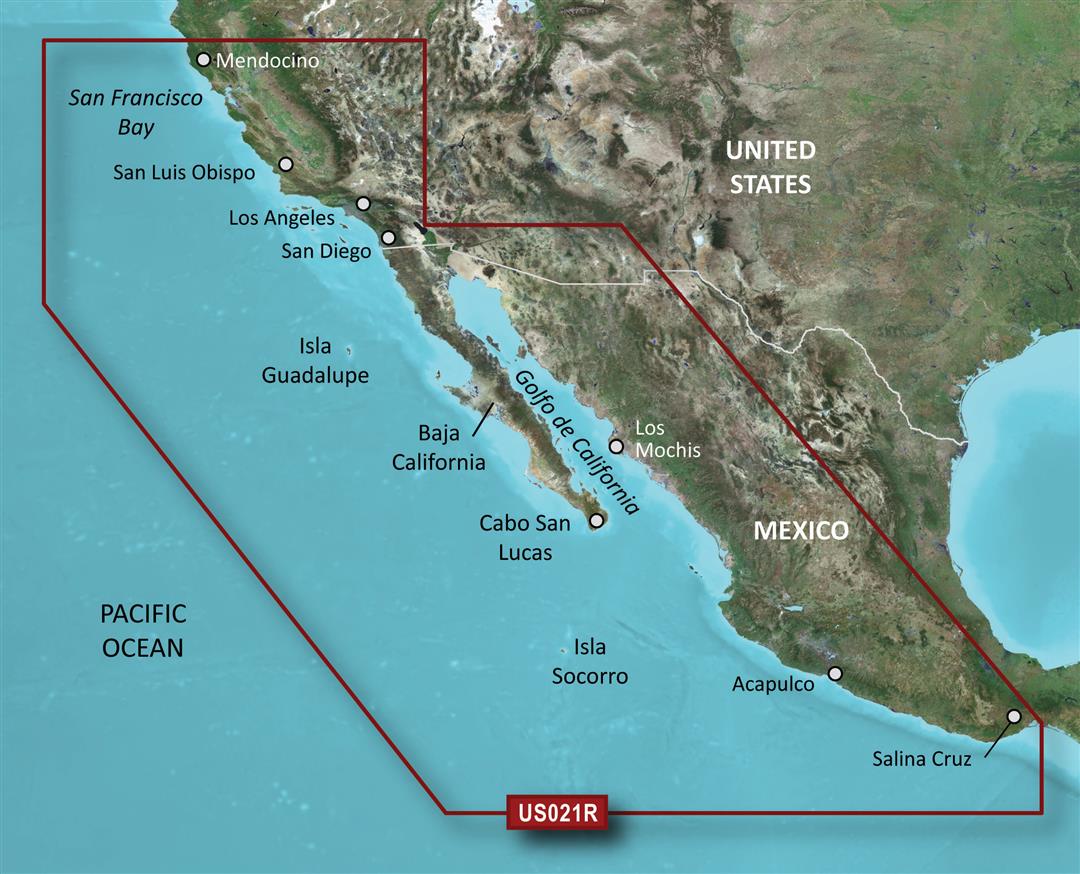
010-C0722-00 Garmin Carto G3V Vus021R – California-Mexico
The 010-C0722-00 Garmin Carto G3V Vus021R is the ultimate marine chart for navigating the California and Mexico coastline. This detailed map covers over 2,000 nautical miles of coastline, ports, and islands from the tip of Baja California to the Oregon border.
Key features:
- Professional Garmin marine cartography
- Over 30,000 soundings, 380 floating aids, and 50 marinas
- High-resolution mapping displaying harbors, channels, rocks, reefs, and wrecks
- Up-to-date marine charts for safe and accurate navigation
- Covers over 100 islands offshore California and Baja California
Whether you’re planning a boating trip or pleasure cruise along the California or Mexican Riviera, this cartography ensures you have the marine mapping needed to explore the region’s busy waterways. The reliable Garmin cartography helps ensure a memorable and safe voyage while enjoying the beautiful coastal scenery and recreational opportunities this region has to offer boaters and mariners.


Reviews
There are no reviews yet.