Description
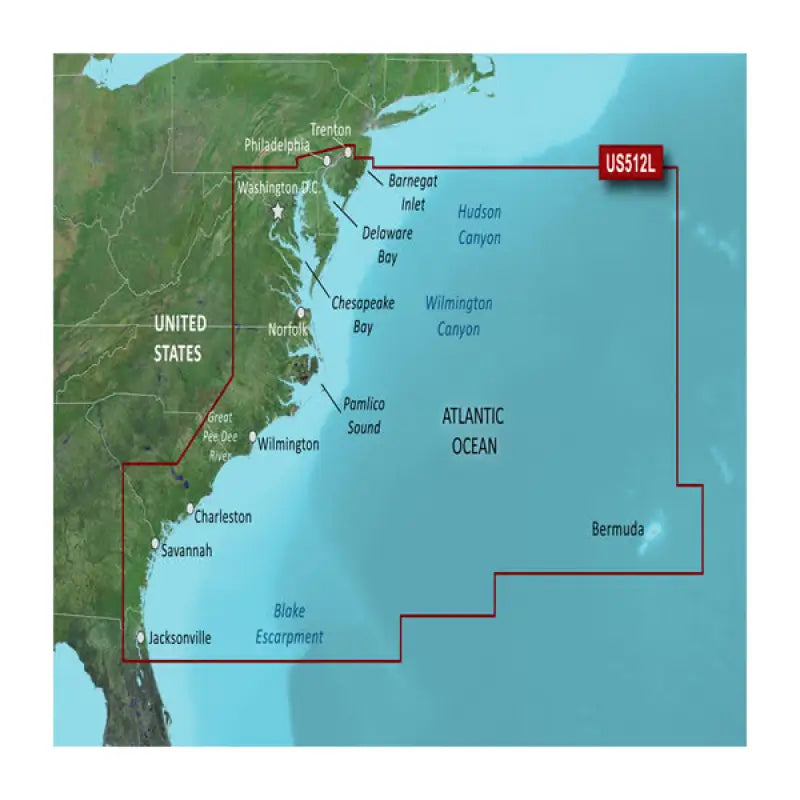
010-C0741-00 Garmin Carto G3V Vus512L – Mid-Atlantic
Discover the ultimate boating chart for the Mid-Atlantic region with the Garmin 010-C0741-00 Carto G3V Vus512L marine map. This cutting-edge marine cartography from Garmin brings you extensive coverage of coastal waters spanning from New Jersey to North Carolina, encompassing the Chesapeake Bay, Delaware Bay, and Pamlico Sound.
Utilizing the latest in marine mapping technology, this chartplotter map delivers precise navigation for both coastal and offshore marine passages. Boaters can rely on highly detailed marine mapping and coastal information essential for safe and enjoyable boating experiences.
The 010-C0741-00 chart boasts nautical charts featuring water depths, navigational aids, marinas, wrecks, obstructions, and more. Moreover, it includes detailed coverage of ports, coastal cities and towns, waterways, landmarks, and other points of interest, ensuring you have comprehensive coastal information at your fingertips.
Perfect for boaters of all experience levels exploring the Mid-Atlantic coast, this marine navigation chart offers high-resolution marine mapping, guaranteeing that you’ll reach your destination while steering clear of potential hazards. Whether you’re navigating the Chesapeake Bay, traversing the Intracoastal Waterway, or embarking on a coastal adventure, the 010-C0741-00 Garmin Carto G3V Vus512L chartplotter map has got you covered.


Reviews
There are no reviews yet.